Japan, Koizumi Sokki
Koizumi Sokki vRTK GNSS Receiver
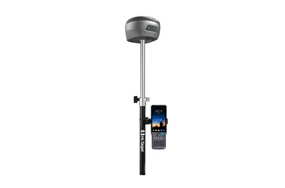
Product made in Japan
Manufacturer : Koizumi Sokki
Model : vRTK
Characteristics
Hi-Target vRTK is an innovative visual RTK GNSS receiver with two cameras. Photogrammetry has made it possible to measure places that are not directly approachable. In addition, the camera on the bottom of the receiver makes it possible to perform surveying work even more efficiently. You can experience productive work with the leap forward vRTK.
Image Positioning
Equipped with a 5Mpixel CCD sensor on the side of the receiver. Coordinates are obtained by photographing locations that cannot be directly observed by the user from a distance.
The usage scene of the GNSS receiver is further expanded.
3D Modeling
It is also possible to export the captured images and arm information in text format for processing with the SfM software.
Combined with images taken by UAV, it is possible to obtain a more detailed model.
Advanced AR measurement function
A 2Mpixel CCD sensor is mounted on the bottom of the receiver. AR measurement with an accuracy of 2 cm is possible.
Stakeout points on the screen are displayed in real time with low latency thanks to the IMU with excellent followability.
Advanced IMU for flexible observation
Equipped with an IMU that enables calibration-free tilt surveying. It is possible to detect the inclination direction with high accuracy even in a magnetic environment that was difficult with the conventional direction sensor method.
Efficiency can be improved by approximately 20% compared to leveling using a vial.
It achieves an accuracy of about 2.5 cm within an inclination angle of 60 degrees.
Features
- High precision positioning
Equipped with an advanced GNSS engine with multi-GNSS and anti-jamming technology. It can receive positioning signals strongly and obtain highly accurate FIX solutions in a short period of time. - Equipped with Hi-Fix technology
RTK positioning accuracy is maintained even when communication is temporarily interrupted and correction information is interrupted. It enables continuous observation in the field with poor communication environment. - Pseudo-dynamic RTK
Even if the FIX solution is lost in a forest, etc., and the float solution is degraded, the previous positioning solution can be used to obtain FIX-equivalent accuracy. - UGypsophila RTK
Satellite systems for which correction information is not distributed can also be incorporated into RTK calculations based on information received on the rover side. - Web management system
You can access the GNSS receiver from a web browser such as a smartphone or PC via WiFi connection. You can check various settings and positioning status in real time. - Robust design conforming to US Department of Defense standards
・Dust and water resistance IP67
・Shock and vibration resistance MIL-STD-810G, 514.6
・Salt damage resistance MIL-STD-810G, 509.4 96 hours
・Free fall MIL-STD-810G, 516.6 2m above concrete - Large-capacity lithium-ion battery
・6,900mAh lithium-ion battery
・RTK (mobile station) can be used for 15 hours - Can be connected to other companies’ apps (Kaisoku Navi, Field Terrace, etc.)
Using the Android app (Hi-Survey), it is possible to transfer GNSS positioning coordinates to other companies’ apps.

